Saturday 2 September 2017

The End: What went wrong, right, what broke, what would I change?

The End: What went wrong, right, what broke, what would I change?

Overall, I was really happy with the bike and my set up.  I didn't have any major regrets.  For me, the Husqvarna 701 is the perfect bike - light enough to pick up, powerful enough to cope with highway sections, and with suspension good enough to cope with the terrain.  For a more road-biased rider, it is compromised though.  The seat is uncomfortable if you actually have to sit on it for any distance - so get standing!

If I don't mention a piece of equipment below, that's almost certainly because I was very happy with it.  There's a list here of what I brought.

In terms of positives, I'd probably give an award to the Helinox Cot.  I'd never really used one before, always using thermarests, but it is so much more comfortable.  There's a bulk penalty (but not weight, I don't think), but it's not as critical on the bike as if I was hiking.  One aspect I hadn't truly appreciated is how forgiving it is of rougher ground.  When I had to pitch on less than perfect sites, even on slight slopes, the bed meant I didn't have an uncomfortable night.

The other bit of kit worth a particular mention is the camera on my iPhone 6s.  Several people have asked how I took these photos - they were all with the standard camera, no accessories, and minimal editing and colour balancing (e.g. cropping).  The best camera is the one you have to hand.  I would never have taken some of these photos with a camera that I couldn't carry immediately to hand, and the iPhone is really quite good.

However, what you really want to know is what went wrong, and what I might change.  In no particular order:
  • Levers.  I broke or bent three out of four levers on the bike.  I would definitely bring all four spare in the future, brake, clutch, rear-brake and gear lever.  Even with brush guards.

  • Laptop.  I had an Asus Chromebook.  First it died in a software style, then hardware.  Ultimately it was down to flex.  I should have carried it in the ortlieb rather than the side pannier.  I'd probably still bring one of these, or something slightly tougher (but still small).  I managed to beg and borrow laptops off friends and in internet cafes when I needed them (e.g. to download new GPX to my Garmin)

Fortunately, it wasn't that expensive...

  • Fairing.  I was really pleased with the fairing.  The screen is a KTM official part, for the 450RFR rally bikes.  The trick is mounting it to the bike itself, and there are several options for doing this.  I used Nomad ADV.  Besides some wind protection, the big benefit was putting my GPS and clocks/lights somewhere I could actually see them when standing up.  I was perfectly happy with the Nomad ADV mounting - I don't think there is another version which does precisely what I want at an equivalent price (e.g. KIT701 is much more expensive).  But it did get slightly bent.  To be honest, I can't tell, except that the way it is constructed means I can tell the sides are no longer straight and inline with the top piece.  If it was welded together it would be much stronger, but it would make assembly difficult, and very hard to access the wiring loom.  It's been bashed around a lot, and I'm surprised actually how resilient the plastic screen has been, so I'm happy with this performance.

  • Panniers.  I've written twice now about the Kriega Overlander 30 Panniers, here and on Facebook.  I was really impressed  by the bags themselves, but the mounting system didn't survive.  The first time, it turned out mine (and lots others) had been threaded incorrectly at the factory.  This isn't a straight-forward user fix.  It requires cutting and restitching the straps, if you want it back to good as new condition after repair.  Kriega, to their immense credit, shipped out a brand new set of panniers and various accessories to me, for free, to Sarajevo.  That won't have been cheap.  It was more than a courtesy.  Unfortunately, with the binding issue fixed, that transfers stress elsewhere and I've managed to damage the new ones too.  This was some rough use - the bike fell and was dragging the panniers against the ground.  I don't necessarily know that any other product would have survived this either, and I don't particularly consider it "fair use".  But it is a possible scenario for others users - or simply me! - in the future.
Round one with the panniers: the buckle slipped, and popped a fastener off (lost)
The loose strap, and the fix I made with cable ties.
Kriega then replaced the panniers with correctly threaded straps, but that transfers the stress elsehwere.  Here a buckle has itself snapped.  Using cable ties again to get me back on the road.  And the metal hook stretched.
  • Gloves.  Buying Klim Dakar Pro gloves, with a full leather, was a last minute decision.  They aren't cheap.  Normally, green laning, I used regular textile Dakar gloves.  I was really grateful for the leather.  It's more comfortable and more durable over longer distances, and protected my hands several times on gravel spills.  But the stitching has come undone.  OK, it's a long trip, but you could reasonably ride 35 days and cover 8000km in an easy year, and I wouldn't expect my gloves to fall apart in that time.  I'll try to put in a warranty claim for these.
  • Number Plate.  Meh, this happens.  It's a flexi-plate for a reason.  This is a consumable item.
  • Boots.  I'm not going to take my Sidi Crossfires home with me.  They're dead.  But I bought them second hand, well worn, and they've put in a good innings.  I consider this fair usage.  I'll buy them again (unless someone recommends anything better!)


What would I improve, or do differently?
  • GPS - hardware buttons.  Overall, the Montana 610 was fine.  I used it in map mode, top down, with the GPX displayed as a track.  I didn't try to "route" along it, not least because of the confusion that would have caused when the track didn't follow a known trail on the mapping data underneath.  But I wish for two things: hardware buttons for zooming in and out.  Countless times, I'd try to zoom in or out for a better overview of the trail, and end up putting down a random "pin" and shifting the focus on the screen.  It would also be nice if there was an easy way to calculate how much of a track was left - how far along it I was.  I ended up guesstimating, but often under-counted how many kilometres there were likely to go.
  • Mapping Data.  Linked to the GPS is the fact I used OpenStreetMap data.  It's free, so I can't complain much.  I was never caught short by it - the track itself was always there, and followable even by dead reckoning if the data was insufficient to show certain tracks and trails.  But after performing brilliantly in Western Europe, stuff started disappearing in Slovenia and Bosnia, and then got pretty silly in Serbia and Romania.  I'd research what other data sources there are for these countries if I was going again.
  • Tyres.  I had to change tyres four times.  I wore through two front tires, and one rear (the other rear was lost to a double-puncture which I then rode on the rim-lock, knowing it would trash the tire).  I used relatively aggressive enduro tyres which already had some miles in.  Overall, though, I would do this again.  I didn't have enough experience to know which tyres I preferred or lasted what time, but now I'm happy with the Mitas C02 on the back.  I would pre-deploy some on my route.  Any tyre fitter can help put them on, or fit them yourself if you didn't mind sweating and swearing and skinning your knuckles.  I'd use an online, European tyre distributor and ship them ahead of me, to friends, hotels or bike shops on the way.  I'm also always going to carry two spare, normal duty tubes!  In fact, I've had three since Sarajevo...
  • Sleeping bag.  Most of the trip, I was hot.  But at altitude, on clear nights, it was cold.  My sleeping bag is a Snugpak Black on Black 2 which is more than fifteen years old.  It needs an update.  I'd probably go for a three season bag, or carry a silk liner.
  • Rope for recovery gear.  I had to use my recovery gear a few times, for different reasons.  The 4mm dyneema cord was more than strong enough.  But I'd get something thicker (like prussick cord), just to cut down even more on the "cheese-wire" effect.
Finally, the route itself.
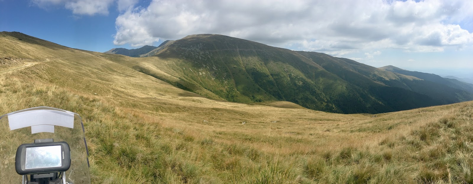
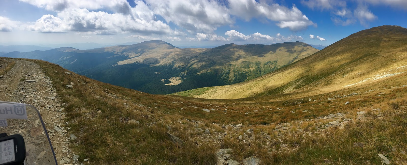
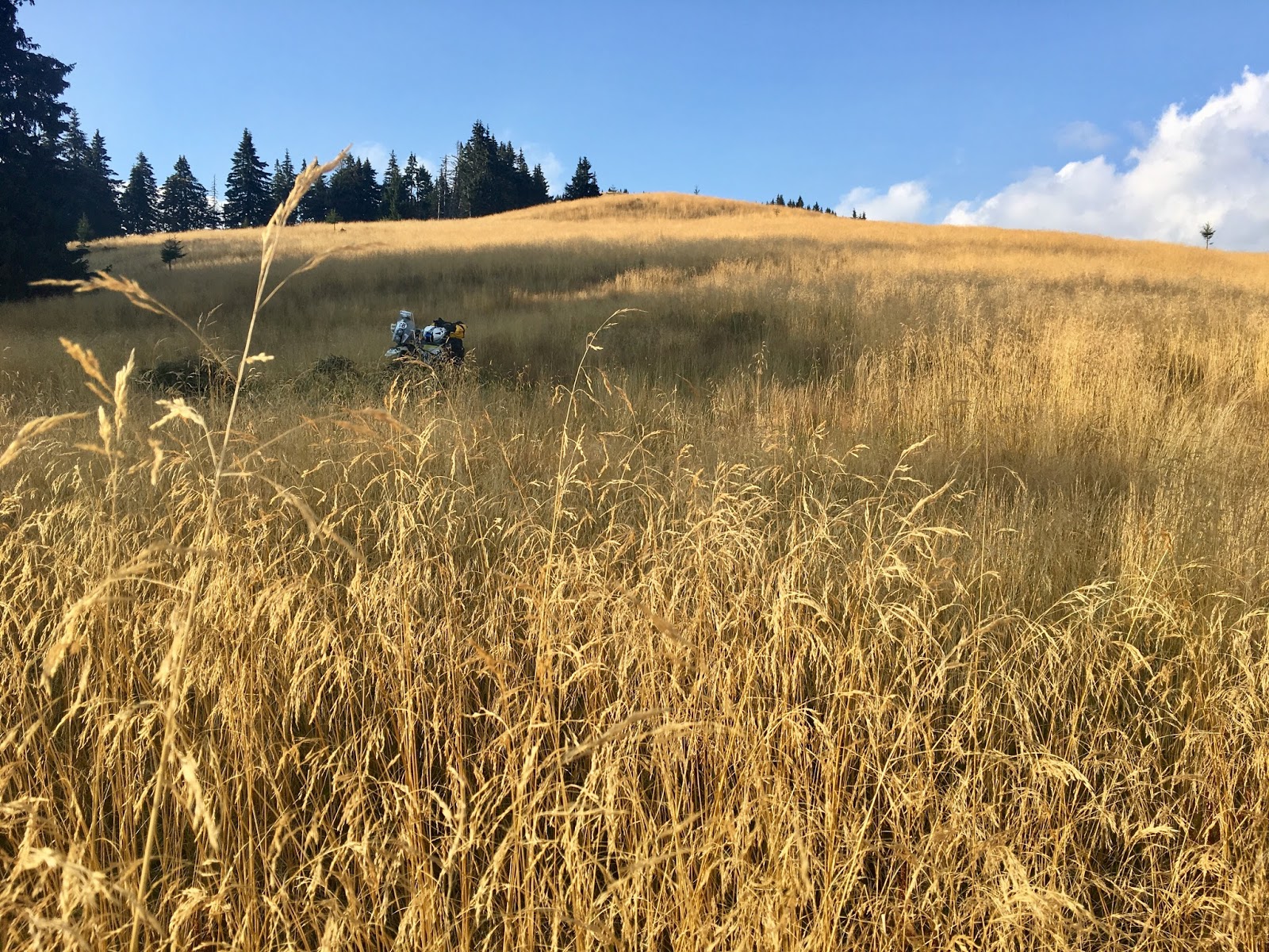
  • I loved riding TET.  I'd certainly ride more, to complete the Balkan loop, see more of Romania, and do the leg north to the Baltics, or south to Spain.  I'll do the UK too one day.  Maybe Scandinavia too, although I still suspect there's a lot of gravel motorway there!  I didn't ride the whole thing in the countries I passed through.
  • With my time again, I'd make broadly the same choices.  I'd still skip the Italian Western Alps in favour of a shortcut through Turin.  Controversially, I might even skip the Dolomites.  There was only one legal, worthwhile trail there.  The mountains and scenery are fantastic, but it's road riding, not trail.  If I had been there before (which I hadn't), I'd think twice about this section.  You could make quick pace to Slovenia by sticking closer to Milan.
  • The other big shortcut I made was to turn left in Montenegro and head for Serbia instead of Albania.  I didn't have time to do anything else.  But I wish I'd gone one border-crossing further so I could see Sjenica Airport and the countryside around there.
  • I'd still do the Sarajevo diversion (this was one of my favourite days!).
  • And besides about 15km of trail near Srednji Povlen, I didn't miss anything from cutting up to Belgrade and rejoining at Kovin.

Reflections on the Balkans & Romania

I've finished.  Reached the end of my Trans Euro Trail ride.  Sitting now in Bucharest, I thought it was worth jotting down some quick notes in terms of my reflections on the last few countries I've ridden through and the TET route across them.  This complements and updates my previous post on France and Italy.


NB: There were virtually no route corrections to make on any of these days - it's a different style of trail-riding to ferreting out the legal bits in Western Europe.

I'm incredibly grateful to Roman Bale, Ivan Drobjnak, Ivan Gligorijevic and Jon Florea.  And overall, cannot understate my praise for John Ross.  I just could not have done this trip without their work.  I had no basis or knowledge on which to plot such a route myself.
  • Slovenia
    • Beautiful country.  My favourite photo of the trip was taken from Mount Nanos.
    • Roman's new loop is very worthwhile doing.  Gives you a great overview of the country.
    • Nothing so technical a big bike could not manage.
    • Takes two days.
    • Last hundred kilometres or so to the border are on gravel motorways.  Combined with the further stretch in Croatia, it get's a bit tiring/boring.  Hence why you must do the new loop first!
  • Croatia
    • As above, the stretch from the border to the coast is long and tree-filled.
    • Climb up from the coast is tricky and engaging, but manageable on a bigger bike.
    • You don't really get to see any famous sights or characteristic features of Croatia (well, except the sea and some islands).  The country has a lot more to offer, but it would need a pretty big change to take the route to those places and probably demand changes elsewhere in Bosnia too to accommodate.  But for v2.0, this is what I'd look to change.
  • Bosnia
    • I think everyone knows Bosnia is a great country to ride off-road.  It really is.
    • Stunning landscape and scenery.
    • If you're coming from further afield and haven't visited Sarajevo, it's worth the trip.  The run from Sarajevo to Mostar was one of my top four days of the whole adventure.
    • Owing to the land-mine threat, there is no single track or really technical riding at all.  It's still good fun, and therefore very manageable on a bigger bike, but it doesn't feel quite as "adventurous" as some of the riding in Romania or Monetenegro or even the muddy single-track in France and Italy.
  • Montenegro
    • Just stunning scenery.  The TET route only takes 1-2 days to cross the country, and is really worth doing.  Another highlight of the trip.
    • There's an easy and obvious short-cut to make into Serbia if you are heading East rather than South.  If you do this, try to cross as far East as possible (more than I did).
  • Serbia
    • I'm really glad I travelled through Serbia, and Belgrade was surprisingly different to what I expected.  Very friendly people.
    • I didn't ride the whole route.  I'd like to know what the south-east is like.  I suspect I missed quite a lot.
    • Unfortunately, in the bits I did ride, the country just doesn't enjoy as much spectacular scenery as it's neighbours (well, except perhaps Hungary!)
    • The route here was more Western European in character, hunting out single-track in wood-blocks and the like.  It makes a nice change from some of the gravel motorways. But there are long-ish road connections between, and you feel the off-road bits are there for the sake of riding off-road - which isn't a bad thing - but not covering terrain.
    • But I was disappointed by Tara National Park.  It had been hyped to me, and is pretty, but doesn't compare with Montenegro, Bosnia or Romania.  The trails are dull here too, graded smooth gravel motorway, and lots of trees to stare at.
    • Highlight in terms of riding is the area around Srednji Povlen.  I'm sorry I missed the second half of this.
    • Delibato Sands are worth the loop.  It's a real contrast to the whole rest of TET to be riding on sand.
    • After Slovenia, Serbia is the first place you are going to find spares/tyres/etc.  Bosnia and Montenegro are too poor and the route doesn't go near the right areas of Croatia.
  • Romania
    • Trail riding heaven, but you knew that already.
    • Given that my expectations were high, I was actually surprised how much tarmac you ride.  As a proportion it's still low, but not like Bosnia.
    • Partly, this is because of geography - the trails run perpendicular to the mountains, rather than along the valleys in between.  You end up criss-crossing the direction of travel.  That makes for easy short-cuts if you want them.
    • You can make good choices about whether to ride another logging road (fun, bouncy stuff - no gravel motorways) or loop another lake (they can be fiddly and much longer than they look on the map) or press on.  But don't miss the ridge-line rides.  These really are worth the loop, and faster too.
    • There are a lot of wild dogs, and they're pretty aggressive.  Packs of them.  This just wasn't a problem anywhere else on the route.
    • The people are very friendly, and visibly accommodating of bikes.

Update: Distances so Far


-->
DayStart FinishDistanceTotal
1LondonBadgell's Wood4141
2Badgell's WoodCalais190231
3CalaisBretuil320551
4BretuilOrleans350901
5OrleansMontluçon3201221
6MontluçonSt Donat1901411
7St DonatMende3101721
8MendeOrange3172038
9OrangePertuis2032241
10PertuisVerdon1882429
11VerdonVentimiglia2902719
12VentimigliaVentimiglia02719
13VentimigliaTurin2802999
14TurinBaveno2603259
15BavenoPisogne3003559
16PisogneForno di Zoldo4183977
17Forno di ZoldoBovec2724249
18BovecZalošče1254374
19ZaloščeŠmihel2184592
20ŠmihelŠtirovača3234915
21ŠtirovačaLake Šator3005215
22Lake ŠatorSarajevo3205535
23SarajevoSarajevo05535
24SarajevoSarajevo05535
25SarajevoMostar1855720
26MostarCvijetino Brdo3126032
27Cvijetino BrdoCrkveni Toci2866318
28Crkveni TociBajina Bašta2906608
29Bajina BaštaBelgrade2156823
30BelgradeBelgrade06823
31BelgradeBozovici3057128
32BozoviciMiru-Bora3167444
33Miru-BoraLake Vidraru2157659
34Lake VidraruMt Leaota1867845
35Mt LeaotaBucharest3138158
36BucharestBucharest08158

My average non-zero distance a day is 263 km.

NB: All distances are from my speedo, and rounded slightly.  Judging by my GPS, my speedo over-registers by 3-6% depending on front tyre and wear.

Friday 1 September 2017

Day 35: Mt Leaota to Bucharest, 313 km. The End.

Day 35 - Mt Leaota to Bucharest, 318 km. The End.

What an awesome finish to my TET!

Boy, did I make the right decision stopping last night, and leaving to the morning 6km of spindly steep single track descent to the valley. Lethal otherwise.
Turns out it was a pretty good spot after all, even in the cold hard light of day.
The bit I forewent last night. Not sorry.
Skipped loop around Lake Bolboci for ridge-lines run north to Brasov. And what a stunner. Fast and flowing up top, but getting there and then up was pretty gnarly.
Please Jon, say I get to ride up that!
I do I do I do!
I'm not sure following the black and white poles along the ridge-top is the DS solution. The route follows the hardcore-covered trail slightly lower. But I was riding in well worn tyre tracks.
You can just make out the trail in the distance.
This was the best ridge-line ride yet, riding right up to and along the precipice.  I did *not* want to overcook any of the blind summits here!  Those poles are essential!

Dropped off TET and the ridge line at Azuga, from the top of a ski-lift down what turned out to be fabulously tight, steep, sinewy MTB single-track.

Then 33km of slab to Brasov for lunch, and the balance of 200km back to Bucharest. Simple. So I thought. But the moment I joined the A3 my fuel light came on, and there are no service stations (just tempting signs for where they might one day be built).
Brasov
Ah. Four kind people stopped but couldn't really help, besides drawing me my natty sign. I called a mate from Bucharest to rescue me with a petrol can.
Even now the riding might have stopped, but adventure hasn't quite yet: still need to work out how my bike and kit is getting home. Glad I've got a bed to sleep in and shower and laundry tonight.

This, I thought just looked pretty.
NB: Functionality disabled to prevent extracting KML. If you want to follow the route, get the latest data from TransEuroTrail.org
Facebook: https://www.facebook.com/groups/Transeurotrail.org/permalink/860131980808614/

Thursday 31 August 2017

Day 34: Lake Vidraru to Mt Leaota, 186km

Day 34 - Lake Vidraru to Mt Leaota, 186km

I had a rough night. Regretted not washing (it was too chilly by the time I realised the stove was out for a cold wash). Dogs barked a mutts' chorus literally all night, to 0430. Not much sleep. Headache. And no coffee this morning!

So I had a gentle start, waiting until the sun was well up to dry the tent and let me sit reading a book and admiring the scenery. Wheels rolling by 1000.
Morning
My confidence took a knock yesterday and I didn't know whether to expect more tough sections. Also, I could see the loop around Lake Vidraru itself looked fiddly. So to save time - this is my last full day on the TET after all - I devised a 40km short cut. It was still off-road, but in lower foothills, and almost-technical single track at that. In fact, when I did pick the trail back up, it was rollercoaster rocks again, fast rather than technical, so I perhaps set myself a trickier run than Jon.

Obirsia
Glad I rejoined where I did. First of two phenomenal ridge-line runs today. Obirsia first. Chatted to some shepherds at the top.  I don't speak a word of Romanian - I don't think I've even got "hello" or "thank you" right.  So this conversation involved a lot of hand-waving and pointing at flag stickers.

It's odd feeling effectively mute in shops and situations like this.  Schoolboy French can get me through those situations there and in Italy, while my Russian gets me most of the way in Serbo-Croat in the Balkans.


I realise now that lots of these ridge-lines look alike. But you get to ride all of them, so enjoy!
That to the right is the way up here. All of it.
Route ahead!
These trees made a nice change from commercial forestry.
Cut a corner to get fuel and food in Câmpulung.

Second run was Leaota, where I made a colossal mistake. From the peak, the route retraces slightly then curls south, but on OSM I could see a trail connecting direct to Lake Bolboci, along the Ratei ridge. There were 4x4 tracks too (at first), and a hut and visible footpath in the distance, so I gave it a go.
You can just about trace the route descending all the way off this ridge.
Summit of Leaota
Looking tempting!
Beautiful light
Unfortunately, the route petered out, but not until I'd spent an age recce'ing wood blocks on foot to find it. I'd lost the back wheel down a bomb-hole already once too, needing luggage off to drag it out. So regretfully I headed back to Leaota to retrace.
Nope. I can conclusively assure you there is not a way off the mountain here.
Tough getting back.
But I just couldn't get the bike back up the steep bits, with rocks and drops hidden in the "baby's-head" grass. Eventually I resorted to dropping tyre pressure and portering my bags on foot to recce, then leapfrogging with the bike. Took an age. I was dripping wet with sweat and getting cold, and could see the sun setting. It was far too windy to set up camp. Without the stove, I'd never warm up.
I tried to see how far I could get in the dusk. If I could reach road before it was pitch-dark, maybe I could run up to Brasov tonight and find a hotel?
Sure, I'll definitely get down from here before dark!
 But night descended much quicker than that, and it turned out the route itself descends a similar-style ridge to the one I'd just battled. I quickly realised this was madness and put up the tent pretty much smack on the trail itself! Fortunately I'd warmed up a bit and it's more sheltered here. Still, not enough water for even a frigid wash, and cold meatballs for supper.
This is new. Setting up shop in the dark.
Maybe I'll get to Brasov tomorrow, before a sprint into Bucharest?

NB: Functionality disabled to prevent extracting KML. If you want to follow the route, get the latest data from TransEuroTrail.org
Facebook: https://www.facebook.com/groups/Transeurotrail.org/permalink/859885410833271/

Wednesday 30 August 2017

Day 33: Miru-Bora to nr. Lake Vidraru, 215km

Day 33 - Miru-Bora to nr. Lake Vidraru, 215km

Tough day, as the distance shows.
Morning just as stunning as last night.
Morning. Check out the clouds in the valley!
Descending off the ridge line through the meadows this morning.
Morning's descent.
Morning was great. Ridge-line ride then descent off moors through forest to meadow below. Amazing views. Moderately tricky descent for final 3km to road (steep earth, rutted with run-off channels).

My confidence I'd outrun the gypsies was misplaced. After hiding in my sleeping bag long enough for the sun to warm up, I emerged to find an old BMW 3 Series a few hundred metres away. Unlike them, I took my litter with me. I was amazed they'd made it down the deeply rutted track - but then later saw an oil sump's load spilled along the trail where someone else hadn't made it. The line of black stuff suggested they didn't notice for a while...
Start of the gorge north to Sibiu
Besides the gypsies and the dogs, though, I've been surprised how friendly and keen on bikes people are. Kids holding out for a high five, fair enough, but parents and old ladies wave as you pass too.
After the briefest of road links, there was a 25km stony, muddy, roller coaster of a ride up a gorge and over almost all the way to Sibiu. Goggle-wettingly deep puddles!
Sibiu.  Former capital of Transylvania.
A silvery mineral in the rocks and sand make the whole route glisten in the sun. And my number plate too.
Lunch in Sibiu. Pretty. Then during a short jaunt back into the hills through farmers' fields I started to think. First, "I've seen other riders further along the route coming a cropper on tricky stuff, but everything so far has been immense fun, even manageable by me on a bigger bike". Then, "I'm in Sibiu, but where do they run Romaniacs? This is too flat surely."

Immediately, I got my butt handed to me by Jon Florea, well tenderised and served on a platter. Really tough section starting up a river, then steep steep steep loose trails with metre deep run-off gulleys to slide into. I fought my way on, as the GPX track and my increasingly exasperated way-point comments will show, tiring myself just by recce'ing on foot, before eventually throwing in the towel and finding an easier way. Fortunately that was easy enough, only a few hundred metres to retrace, but even then I had to pick my way and double back a couple of times from the terrain. Brilliant on a smaller bike with less luggage, or just more skill, but worth treading carefully if not!
Beginning of the tricky bit. Run up a river.
Arse. Picked the wrong rut. Backed up and got up the right side eventually.
My shortcut. Made me feel better about not managing Jon's beastly bit!
Just finding somewhere to camp.
After Jon's beastly bit, normal service more or less resumed, with sandy runs through villages and past horse-drawn carts. Except for one horrid descent that I half fell, half footed it down.
Stopped in a meadow by some abandoned shepherd's crofts. Hoping the sheep opposite and men herding them mean no wolves or bears here.
Partly it's my lack of skill and experience, and the bags don't help (lofting the front more readily on silly steep stuff), but I also lack the confidence to commit to some of the more explosive bits necessary to bounce up some of this stuff.

To think, I was worrying about reaching Brasov too soon!

Stove not working. Low gas, probably. Good job I had a big lunch. Cold beans tonight. Smelly. No coffee in the morning!

NB: Functionality disabled to prevent extracting KML. If you want to follow the route, get the latest data from TransEuroTrail.org
Facebook: https://www.facebook.com/groups/Transeurotrail.org/permalink/859443164210829/