Thursday 31 August 2017

Day 34: Lake Vidraru to Mt Leaota, 186km

Day 34 - Lake Vidraru to Mt Leaota, 186km

I had a rough night. Regretted not washing (it was too chilly by the time I realised the stove was out for a cold wash). Dogs barked a mutts' chorus literally all night, to 0430. Not much sleep. Headache. And no coffee this morning!

So I had a gentle start, waiting until the sun was well up to dry the tent and let me sit reading a book and admiring the scenery. Wheels rolling by 1000.
Morning
My confidence took a knock yesterday and I didn't know whether to expect more tough sections. Also, I could see the loop around Lake Vidraru itself looked fiddly. So to save time - this is my last full day on the TET after all - I devised a 40km short cut. It was still off-road, but in lower foothills, and almost-technical single track at that. In fact, when I did pick the trail back up, it was rollercoaster rocks again, fast rather than technical, so I perhaps set myself a trickier run than Jon.
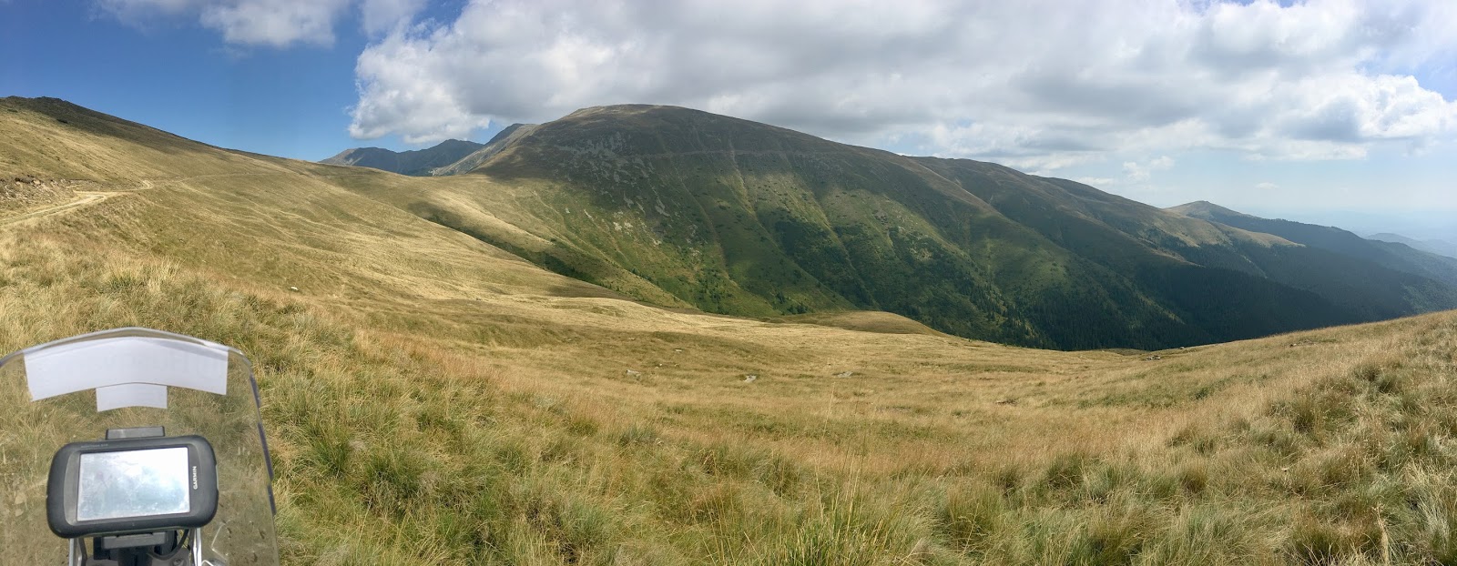
Obirsia
Glad I rejoined where I did. First of two phenomenal ridge-line runs today. Obirsia first. Chatted to some shepherds at the top.  I don't speak a word of Romanian - I don't think I've even got "hello" or "thank you" right.  So this conversation involved a lot of hand-waving and pointing at flag stickers.

It's odd feeling effectively mute in shops and situations like this.  Schoolboy French can get me through those situations there and in Italy, while my Russian gets me most of the way in Serbo-Croat in the Balkans.


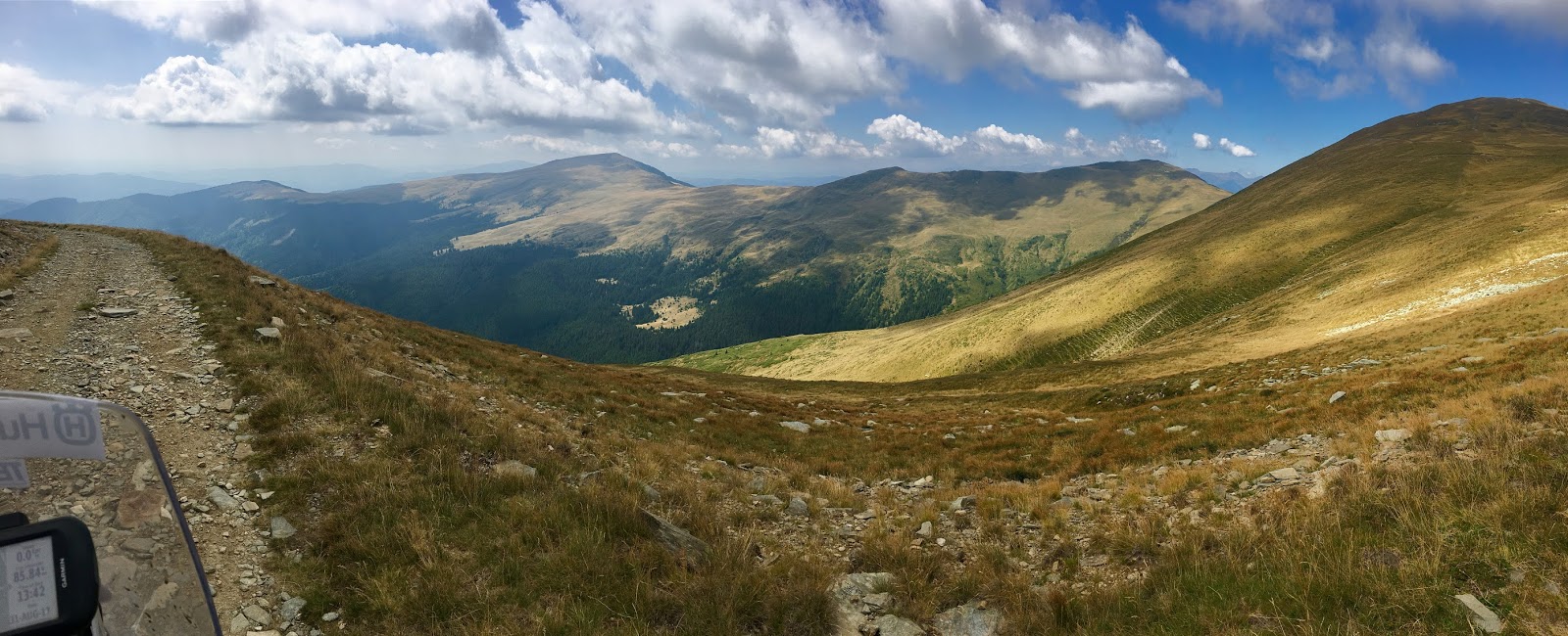
I realise now that lots of these ridge-lines look alike. But you get to ride all of them, so enjoy!
That to the right is the way up here. All of it.
Route ahead!
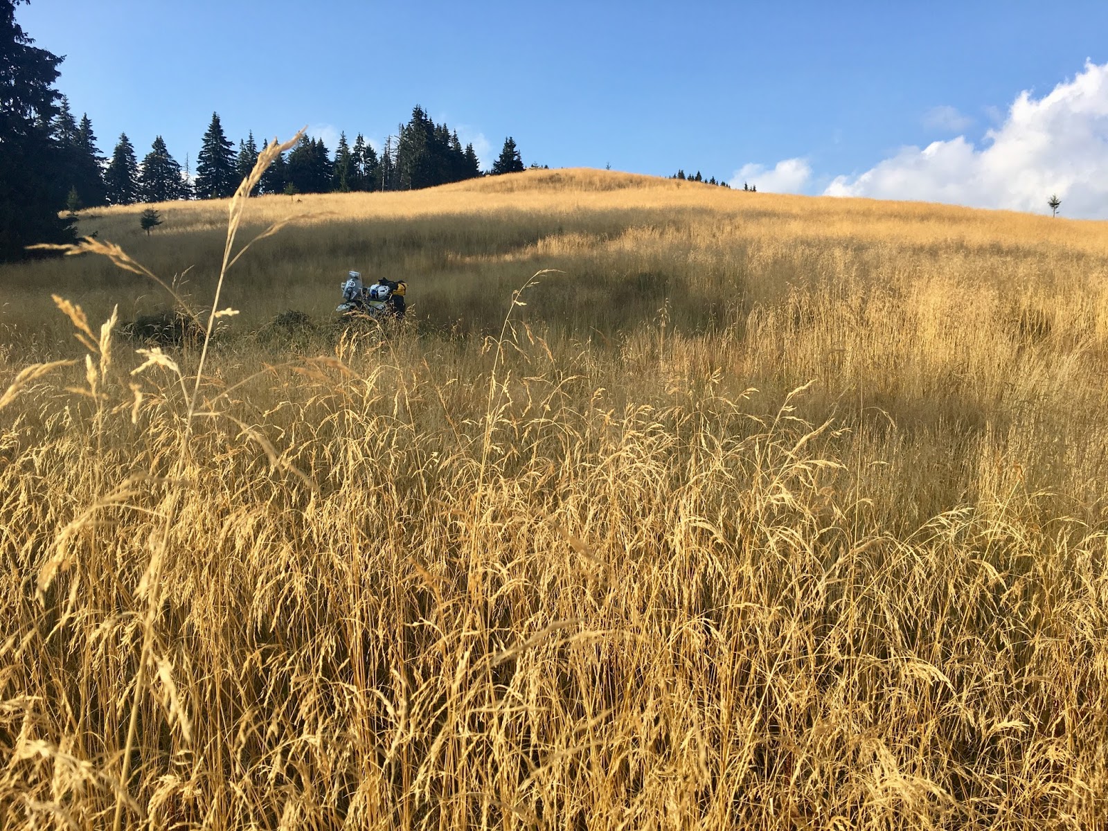
These trees made a nice change from commercial forestry.
Cut a corner to get fuel and food in Câmpulung.

Second run was Leaota, where I made a colossal mistake. From the peak, the route retraces slightly then curls south, but on OSM I could see a trail connecting direct to Lake Bolboci, along the Ratei ridge. There were 4x4 tracks too (at first), and a hut and visible footpath in the distance, so I gave it a go.
You can just about trace the route descending all the way off this ridge.
Summit of Leaota
Looking tempting!
Beautiful light
Unfortunately, the route petered out, but not until I'd spent an age recce'ing wood blocks on foot to find it. I'd lost the back wheel down a bomb-hole already once too, needing luggage off to drag it out. So regretfully I headed back to Leaota to retrace.
Nope. I can conclusively assure you there is not a way off the mountain here.
Tough getting back.
But I just couldn't get the bike back up the steep bits, with rocks and drops hidden in the "baby's-head" grass. Eventually I resorted to dropping tyre pressure and portering my bags on foot to recce, then leapfrogging with the bike. Took an age. I was dripping wet with sweat and getting cold, and could see the sun setting. It was far too windy to set up camp. Without the stove, I'd never warm up.
I tried to see how far I could get in the dusk. If I could reach road before it was pitch-dark, maybe I could run up to Brasov tonight and find a hotel?
Sure, I'll definitely get down from here before dark!
 But night descended much quicker than that, and it turned out the route itself descends a similar-style ridge to the one I'd just battled. I quickly realised this was madness and put up the tent pretty much smack on the trail itself! Fortunately I'd warmed up a bit and it's more sheltered here. Still, not enough water for even a frigid wash, and cold meatballs for supper.
This is new. Setting up shop in the dark.
Maybe I'll get to Brasov tomorrow, before a sprint into Bucharest?

NB: Functionality disabled to prevent extracting KML. If you want to follow the route, get the latest data from TransEuroTrail.org
Facebook: https://www.facebook.com/groups/Transeurotrail.org/permalink/859885410833271/

Wednesday 30 August 2017

Day 33: Miru-Bora to nr. Lake Vidraru, 215km

Day 33 - Miru-Bora to nr. Lake Vidraru, 215km

Tough day, as the distance shows.
Morning just as stunning as last night.
Morning. Check out the clouds in the valley!
Descending off the ridge line through the meadows this morning.
Morning's descent.
Morning was great. Ridge-line ride then descent off moors through forest to meadow below. Amazing views. Moderately tricky descent for final 3km to road (steep earth, rutted with run-off channels).

My confidence I'd outrun the gypsies was misplaced. After hiding in my sleeping bag long enough for the sun to warm up, I emerged to find an old BMW 3 Series a few hundred metres away. Unlike them, I took my litter with me. I was amazed they'd made it down the deeply rutted track - but then later saw an oil sump's load spilled along the trail where someone else hadn't made it. The line of black stuff suggested they didn't notice for a while...
Start of the gorge north to Sibiu
Besides the gypsies and the dogs, though, I've been surprised how friendly and keen on bikes people are. Kids holding out for a high five, fair enough, but parents and old ladies wave as you pass too.
After the briefest of road links, there was a 25km stony, muddy, roller coaster of a ride up a gorge and over almost all the way to Sibiu. Goggle-wettingly deep puddles!
Sibiu.  Former capital of Transylvania.
A silvery mineral in the rocks and sand make the whole route glisten in the sun. And my number plate too.
Lunch in Sibiu. Pretty. Then during a short jaunt back into the hills through farmers' fields I started to think. First, "I've seen other riders further along the route coming a cropper on tricky stuff, but everything so far has been immense fun, even manageable by me on a bigger bike". Then, "I'm in Sibiu, but where do they run Romaniacs? This is too flat surely."

Immediately, I got my butt handed to me by Jon Florea, well tenderised and served on a platter. Really tough section starting up a river, then steep steep steep loose trails with metre deep run-off gulleys to slide into. I fought my way on, as the GPX track and my increasingly exasperated way-point comments will show, tiring myself just by recce'ing on foot, before eventually throwing in the towel and finding an easier way. Fortunately that was easy enough, only a few hundred metres to retrace, but even then I had to pick my way and double back a couple of times from the terrain. Brilliant on a smaller bike with less luggage, or just more skill, but worth treading carefully if not!
Beginning of the tricky bit. Run up a river.
Arse. Picked the wrong rut. Backed up and got up the right side eventually.
My shortcut. Made me feel better about not managing Jon's beastly bit!
Just finding somewhere to camp.
After Jon's beastly bit, normal service more or less resumed, with sandy runs through villages and past horse-drawn carts. Except for one horrid descent that I half fell, half footed it down.
Stopped in a meadow by some abandoned shepherd's crofts. Hoping the sheep opposite and men herding them mean no wolves or bears here.
Partly it's my lack of skill and experience, and the bags don't help (lofting the front more readily on silly steep stuff), but I also lack the confidence to commit to some of the more explosive bits necessary to bounce up some of this stuff.

To think, I was worrying about reaching Brasov too soon!

Stove not working. Low gas, probably. Good job I had a big lunch. Cold beans tonight. Smelly. No coffee in the morning!

NB: Functionality disabled to prevent extracting KML. If you want to follow the route, get the latest data from TransEuroTrail.org
Facebook: https://www.facebook.com/groups/Transeurotrail.org/permalink/859443164210829/

Tuesday 29 August 2017

Day 32: Bozovici to Miru-Bora, 316 km

Day 32 - Bozovici to Miru-Bora, 316 km

I'm now properly out of the foothills. Camped in an amazing spot above the clouds, watching a dramatic sunset.

Day started with some nice trails to reach the sulphurous Băile Herculane (Hercule's Baths), with its romantically dilapidated Austro-Hungarian architecture. Then wonderful bouncy muddy loop of Iovanu Resevoir, and logging roads up and over the valley - poor condition, so high-value fun.

Slightly frustrating that many of the trails seem to run perpendicular to the main valley and direction of travel, meaning some big zig-zags. Towards the end of the day, the temptation of 8km to shortcut Vulcan Pass (25km trail, then 50km of road back up) was too great. Glad I did though, otherwise I wouldn't have been out of the trees before sunset.

This morning's meadow.
And the trails to leave it. Nothing technical today (that couldn't be easily side-stepped), so suitable for even a novice on a bigger bike, but still engaging great fun - scarcely any dull gravel!
New country, new sticker! Probably the last of the set 
Iovanu Resevoir
Heading through another gorge.
That looks a bit steep... Yeah, nope. That's fifty degrees. I had trouble standing up! Fortunately it was an easy loop round.
Donkeys this time.
Miru-Bora National Park. Currently, occupied by gypsies. So never mind the "no camping" signs. Separately, I've had to dodge a lot of angry loose dog's here, far more than in other countries so far.
Sun setting, clouds forming below.
I loved this sunset and the clouds clinging to the hills below. So much so, that I went a bit nuts taking photos of it. There are a few here...
Outcrop I finally stopped on. I'm actually out if the national park by now, nearest peak is Puru at 2059m
Looking back towards the sun. You can just see the trail too behind.
 

Beautiful
Tent's up!
Camping above the clouds. Going to be cold again tonight. In fact, all day; after 39 Celsius in Belgrade, 18 today was refreshingly chilly. Heated grips on for first time since Dolomites.

Sun finally disappearing.
NB: Functionality disabled to prevent extracting KML. If you want to follow the route, get the latest data from TransEuroTrail.org
Facebook: https://www.facebook.com/groups/Transeurotrail.org/permalink/858598190961993/